Palakkad is usually discussed in terms of politics, agriculture, railways or the Palakkad Gap. But one of the most fascinating stories buried under our soil is far older, far bigger and far stranger: Palakkad was once physically attached to Madagascar.
This is not myth or imagination. This is hard geology, backed by plate tectonics, radiometric dating, palaeomagnetism and field studies. The rocks of Palakkad carry fingerprints of an ancient world where India, Madagascar, Africa and Antarctica sat together as a single supercontinent.
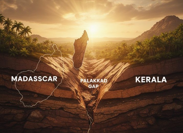
This post unpacks that story in simple language — what broke, what moved, and how a piece of Kerala drifted 7,000 km away.
The Old Supercontinent: Gondwana
About 550–120 million years ago, the southern continents were locked together in a massive landmass called Gondwana. It included:
• India
• Madagascar
• Africa
• Antarctica
• Australia
• South America
Kerala, including present-day Palakkad district, lay along the boundary between the Indian craton and the Madagascar block.
The Palakkad region played a crucial role because the Palakkad–Cauvery Shear Zone was one of the fracture lines where Gondwana later tore apart.
How We Know Madagascar Was Connected to Kerala
This connection isn’t guesswork. Scientists rely on several hard evidence streams.
1. Matching rocks and minerals
Field studies show that Khondalite, Charnockite and Granulite rock belts in Palakkad have identical age, composition and metamorphic history to rocks in:
• Northern Madagascar
• Sri Lanka
• East Antarctica
This rock group is called the Southern Granulite Terrain.
2. Radiometric dating
Uranium–lead and argon-argon dating methods show:
• Rocks in Palakkad: 550–600 million years old
• Rocks in Madagascar’s Antananarivo block: 550–600 million years old
The ages match almost perfectly, proving they formed together before splitting.
3. Shear zones line up
The Palakkad–Cauvery Shear Zone continues across the Indian Ocean as:
• Ranotsara Shear Zone in Madagascar
They are literally the same geological fracture, separated only after India drifted away.
4. Palaeomagnetic evidence
Magnetic signatures in the rocks indicate:
• Palakkad and Madagascar sat at the same latitude before India broke off.
• They moved apart only around 88–90 million years ago.
The Great Split: India and Madagascar Part Ways
Around 90 million years ago, hot magma rose from the mantle, creating rift zones. This rift tore India and Madagascar apart.
What happened then:
• The crust thinned and cracked
• Magma welled up into the gaps
• The Indian plate broke away
• Madagascar remained behind, attached to Africa
India then raced northwards at 15–20 cm per year, one of the fastest tectonic movements ever recorded in Earth history. This speed explains why India smashed into Asia so violently, raising the Himalayas.
Meanwhile, Palakkad and all of South India drifted thousands of kilometres, leaving Madagascar far behind.
The Palakkad Gap: A Deep, Ancient Feature
The famous Palakkad Gap — the 32 km wide breach in the Western Ghats — is not simply a gap in hills. It is the surface expression of ancient tectonic weakness.
Geologists consider it part of the Gondwana fracture zone.
What makes the Palakkad Gap special:
• One of the oldest tectonic valleys in India
• A weak crustal zone formed during Gondwana rifting
• Later shaped by weathering and river erosion
• Continues as a lineament under the Indian Ocean floor
This is why wind, climate and even human culture differ across the gap — it is literally a tear scar from Gondwana times.
Evidence Found Inside Palakkad District
Several local formations tell the story clearly:
1. Charnockite hills of Malampuzha, Dhoni and Walayar
These are high-grade metamorphic rocks identical to Madagascar’s charnockite belt.
2. Granulite belts of Attappady–Mannarkkad
Same mineralogical structure as Madagascar’s southern granulite blocks.
3. Shear-zone rocks near Kollengode, Nenmara and Chittur
These show crushing, folding and ductile deformation typical of major continental collisions and separations.
4. The Bhavani–Siruvani–Kunthi river system
These rivers follow ancient tectonic fractures stretching towards the Palakkad-Cauvery line.
Every rock, every ridge, every valley here is a chapter in Earth’s tectonic history.
Where Kerala Was Located on the Map
Before the split, Kerala sat:
• West of present-day Tamil Nadu
• Attached to north-western Madagascar
• Near the coast of what is now Mozambique
• Much closer to Antarctica
Sea levels, climate and biodiversity were entirely different. Tropical Kerala did not exist yet.
What Kerala and Madagascar Still Share
Even today, echoes of that ancient connection remain:
1. Similar rock formations
Granulites, charnockites and khondalites across both regions still match.
2. Matching gemstones
Ruby, sapphire and garnet deposits share the same metamorphic origins.
3. Soil chemistry similarities
Parts of Palakkad and Madagascar show comparable lateritic soil profiles — formed from the same parent rocks.
4. Unique biodiversity relics
Though evolution took different paths later, some ancient plant lineages trace back to common Gondwanan ancestry.
Why This Matters
Understanding the Palakkad–Madagascar link helps us:
• study tectonic hazards
• understand Western Ghats evolution
• map groundwater and mineral resources
• read climate changes over millions of years
• appreciate South India’s deep geological heritage
It also gives a strange, humbling perspective: the ground we stand on today once slid halfway across the planet.
A 90-Million-Year Journey
Palakkad is more than a cultural gateway of Kerala. It is a geological time capsule. Its rocks tell the story of a continent that broke, drifted and reshaped the world.
The next time you look at the Palakkad Gap, think of it not as a simple break in the Ghats, but as a rift scar from the time when Kerala touched Madagascar — and the whole southern hemisphere was one giant supercontinent called Gondwana.